Isochrones are concentric lines representing all points from which it takes a given amount of time to reach another chosen place by a mode of transport, akin to the pressure bars on a weather reports or the altitude contours on maps. The isochrones were made using the Traveltime plugin in QGIS, more information on which is here[1].
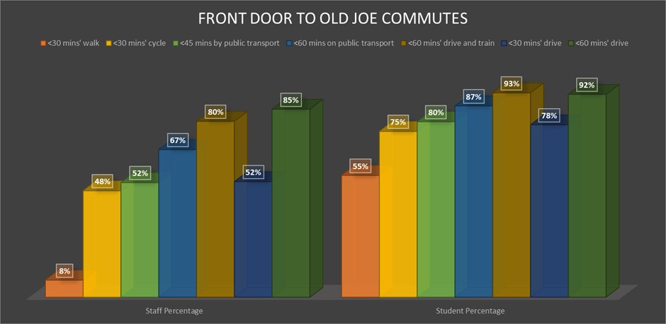
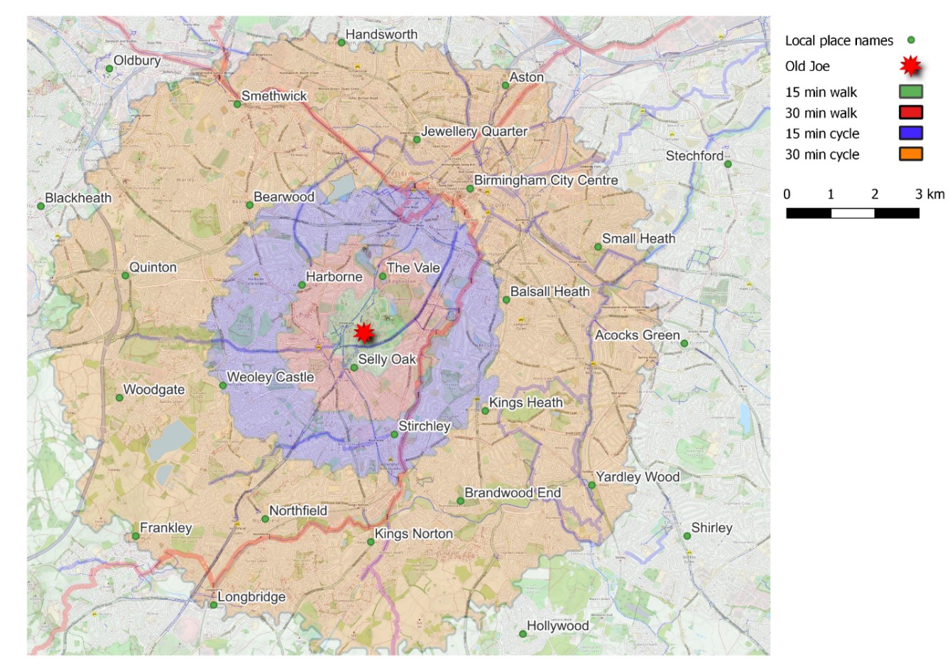
Focusing solely on the main campus, the maps below show isochrones of possible commutes to Old Joe, arriving between 8 a.m. and 9 a.m. on a weekday morning in winter 2022/2023. From there, it is possible to show the percentages of staff and students that live within different commute times by mode.
Active Travel
The proportions of staff and students with potential walking and cycling commutes of 30 minutes suggest there is a potential active travelling population of at least 30,000. Road safety and lack of infrastructure is the main brake on commuting by bike, and personal safety is a concern for commuters on foot, so making improvements to local highways and pavements, coupled with other measures to boost cycling and walking on campus, could see another 10,000 cyclists and pedestrians. The base map shows cycling infrastucture in blue and red, which is good in places, poor in others and piecemeal in the round.
Local public transport
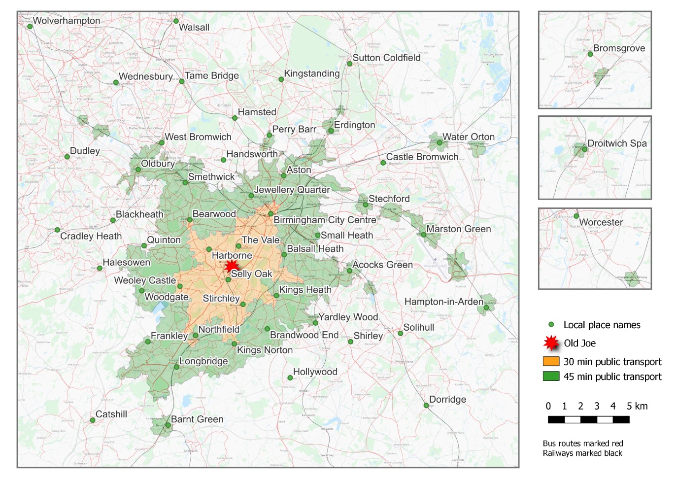
Over half of all staff members and four out of five students live within 45 minutes of Old Joe by public transport and a connecting foot journey. The isochrones show the limitations of the bus network in Birmingham. The main bus routes are radial and terminate in the city centre, so the quickest journeys are only available on the direct routes and so are limited to the southwest of the city. Travelling from other compass points generally requires a city-centre change, walking connection and extra time. Minor, circumferential routes connecting local centres, for example the 48 towards Bearwood and the 76 towards Kings Heath (and beyond), are less frequent and only make a quick 30 minute connection possible in narrow triangular corridors. The local rail network speeds up the journeys from certain pockets around train stations, but the lack of a denser web of commuter railways, tramlines or prioritised buses is visible in many areas where there are no 45-minute commutes available.
Regional public transport
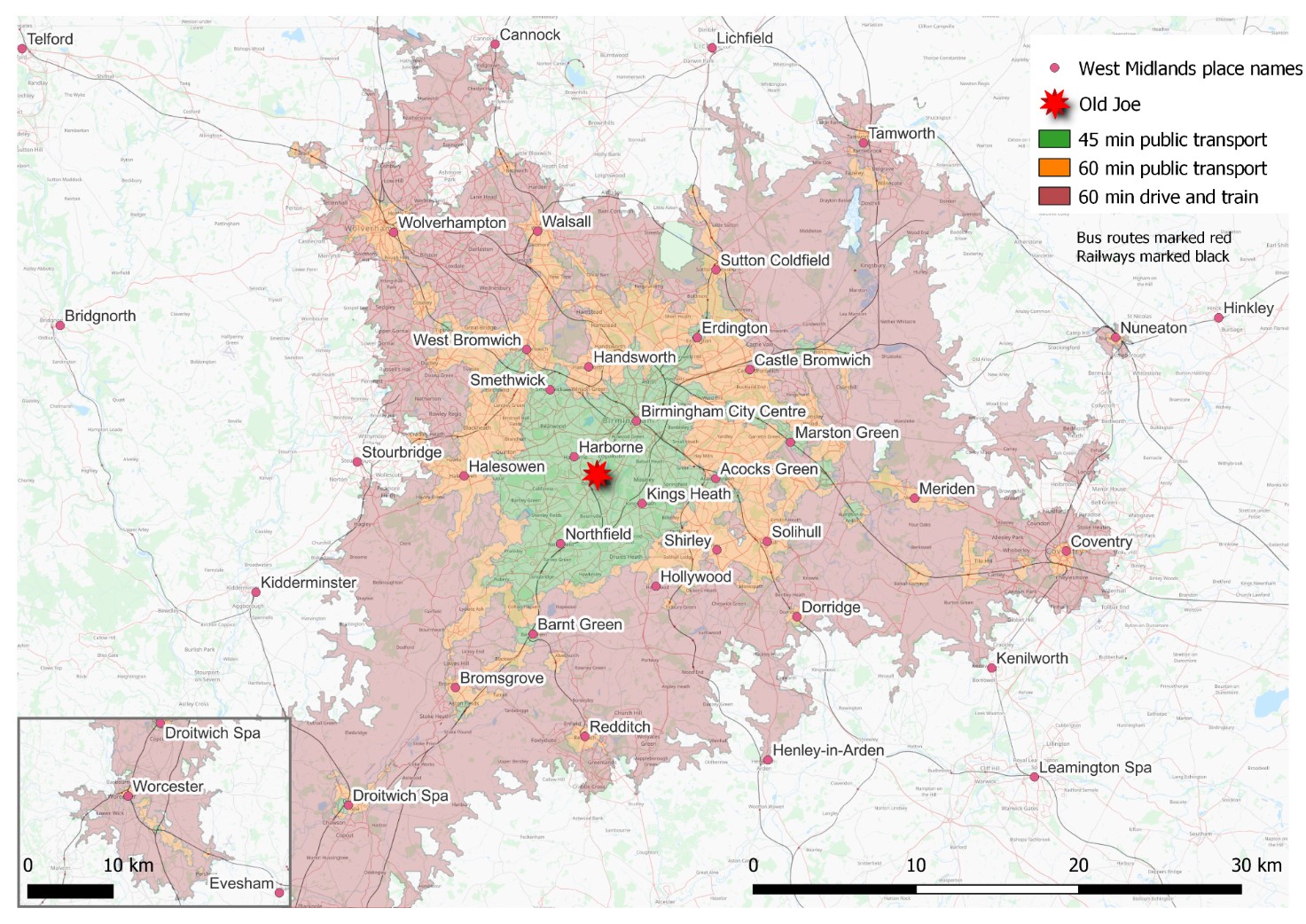
Two thirds of staff and seven out of eight students live within 60 minutes of campus by public transport. The shape of this zone shows where there are train stations with express services. A further 13% of staff and 6% of live within the red zone, where there is a 60 minute train journey for anyone who can drive or get a lift to the station, and its size shows the importance of station parking facilities in outer suburbs and rural locations not covered by frequent commuter buses.
[1] Data Suite (traveltime.com)